İyi İnsanlar Güzel Yarınlar İnşa Eder!
İyi İnsanlar Güzel Yarınlar İnşa Eder!
İyi İnsanlar Güzel Yarınlar İnşa Eder!
İyi İnsanlar Güzel Yarınlar İnşa Eder!
İyi İnsanlar Güzel Yarınlar İnşa Eder!
İyi İnsanlar Güzel Yarınlar İnşa Eder!
İyi İnsanlar Güzel Yarınlar İnşa Eder!
İyi İnsanlar Güzel Yarınlar İnşa Eder!
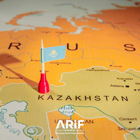
Kazakhstan is one of the Turkic states in Central Asia. It is bordered by Russia, Ural Mountains and South Siberia to the north, Mongolia and East Turkestan to the east, Kyrgyzstan, Uzbekistan, Aladag, God Mountains and Aral Lake to the south, and the Caspian Sea to the west. Its eastern and western borders are 3000 km apart and its northern and southern borders are 1500 km apart. Its area is 2,717,300 km2 (9th largest country).
The official language is Kazakh and Russian. The form of government is a republic. The country gained its independence on December 16, 1991. With a total population of 16,195,000 (61.) people, the country’s ethnic structure is diverse. Kazakh Turks make up 63% of the country’s population, Russians 24%, Uzbeks 3%, Ukrainians 2%, Uyghurs 1.4%, Tatars 1.3%, Germans 1.1% and other nationalities 4.5%.
History
Kazakhs appeared on the stage of history in the 15th century. During the reign of the Shaybani ruler Abu’l-Hayr, the Turkic tribes living in the steppe region migrated to the east under the rule of Janibek and Kerey, sons of Barak Khan of the same dynasty, and made the lands of Chagatai Khanate their homeland. They united with the nomadic Turkic tribes living there and reached a population of two hundred thousand people. When the Naymans, Jalaylis and Dughlats joined them later, a Kazakh community of one million people was formed. Those living around Balkhash were ruled by Janibekoglu Qasim Khan and those living in the region up to the Urals were ruled by Kereyoglu Burunduk Khan.
Qasim Khan eliminated his uncle’s son Burunduk Khan, took all Kazakhs under his rule and formed an army of three hundred thousand men. After Qasim Khan, his son Aknazor Khan (1520-1555) and after him his son Shigay Khan (1555-1570) became the ruler of Kazan. During the reign of Shigay Khan, the entire steppes came under Kazakh rule. Tawakkel Khan (1570-1600), who succeeded Shigay Khan, captured Tashkent and made it the capital. He divided Kazakh lands into three separate “orda”. From west to east, the part covering the Semirajiye region north of the Tien Shan was called the Great Horde (Uluyüz), the part covering the central steppe region east of the Aral Lake was called the Middle Horde (Ortayüz) and the part between the Aral Lake and the Ural River was called the Small Horde (Kiçiyüz). His brother Isim Khan (1600-1623), who succeeded Tevekkel Khan, waged continuous wars against the Chungarian Kalmuks (Oryats). His brother Cihangir (1623-1655), who succeeded him, defeated the Kalmuks in 1626. After Cihangir Khan, his son Tekva Khan (1655-1678) succeeded him.
Russian Occupation
During the reign of Pulta Khan (1678-1718), who became sultan after Tekva Khan, the Chungarian Kalmyks captured the regions up to Turkestan. The unity of Kazakhs was broken. The armies started to fight with each other. Taking advantage of this situation, the Russians first took the Small Ordas (1731), then the Middle Ordas (1743), and then the Great Ordas (1846) under the administration of Hokand Khanate under their sovereignty. Thus, all Kazakh lands fell into the hands of Tsarist Russia. From the second half of the 19th century, new settlement centers were established in Kazakh lands and Russians were settled. In 1916, when the entire male population between the ages of 19-43 was called up for military service, the Kazakhs revolted. However, this rebellion was suppressed by the Russians in a bloody way.
After the 1917 revolution, a Kazakh government called Alash Orda was established.
The Red Army invaded Kazakhstan in 1920 and a Soviet republic was established in Oranburg. Alma-Ata later became the capital. Nomads were forced to settle in 1929. Large numbers of Russians and Ukrainians were settled in Kyrgyzstan. Kazakhs who opposed this were brutally massacred. Kazakh children were tried to be raised as atheists, far from national and religious culture, but they failed. With a new arrangement made in 1936, the Kazakh Autonomous Region was transformed into the Soviet Socialist Republic of Kazakhstan. After the Glasnost movements in Russia and the dissolution of the former Soviet Union in August 1991, the Republic of Kazakhstan declared its independence.
Physical Structure
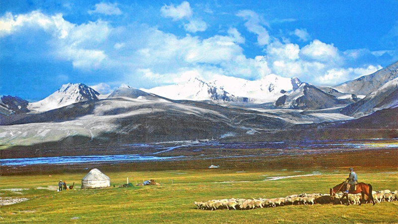
One fifth of the country’s territory is covered with mountains. The other part consists of plains, hilly plains and plateaus. To the south of the Caspian Depression, which dominates the western and southwestern parts, lies the Ustyurt Plateau, and on the Mangyshlak Peninsula lie Karadag and Akdag. The Ural Plateau and the Mugodjar Hills separate the Caspian Depression from the vast Turanian Plain. The sands previously carried by dried rivers formed the Kyzylkum Desert in the south, the Karakum Desert in the central part, and the Great and Small Barsuki deserts in the north. The height of the mountains in the north reaches 1500 meters. There are mountain ranges known as Uludag in the west and Cengizdag in the east of the country. The high mountain ranges in the east and southeast are cut by valleys. The Chungarya Aladagh Mountains enter the territory of Kazakhstan from the south of the depression where Lake Balkhash is located, the Tarbagatay Mountain Range from the south, and the Listvyaga, Holzun and Tigirek mountain ranges, which are the continuation of the Altai mountain range, enter the territory of Kazakhstan from the east. The God Mountains lie on the border with Kyrgyzstan. The Muyunkum Desert goes deep into Montenegro.
Kazakhstan has thousands of small rivers. Most of these rivers flow into the Caspian Sea, Aral, Balkhash and Tengiz lakes. The rivers that cross the territory of Kazakhstan and flow into the Arctic Ocean are the Irtysh, Ishim and Tobul. Most of the rivers dry up in summer. The main rivers are Ural and Seyhun. There are many dams on the Seyhun to prevent floods and for irrigation purposes.
There are nearly fifty thousand lakes within the borders of the country, the water level of which is generally variable and some of which dry up in certain months. The 2320 km coast of the Caspian Sea is within the borders of Kazakhstan. Other important lakes are Aral, Balkash, Zaysan, Alakol, Tengiz and Seletitengiz.
Climate
A very harsh continental climate prevails in the valleys and plains of Kazakhstan. The temperature varies greatly according to the regions. The average winter temperature ranges between -5°C and -1.4°C in the south, dropping to -16°C and -19°C in the central parts. The average summer temperature is 20°C in the north and 29°C in the south. Average annual rainfall varies between 200-300 mm in the north and central parts, 400-500 mm in the south and 600-1000 mm in the high mountain ranges. Winds of hurricane force often blow in the valleys.
Natural resources
Mines Kazakhstan is rich in underground resources. There are rich coal deposits in the Karaganda region, oil deposits in the Ural-Enba Basin. Copper, lead (in Altai, Kara-Tav, Ala-Tav, Tekeli), zinc (Alma-Ata), iron (Karkarali, Balkhach, Cez-Kazgon, Ata-Su), manganese, tin, tungsten, molybdenum, antimony are also mined.
Vegetation and animals: Wormwood and tamarisk grow in the deserts covering most of the country’s territory. Altai and God Mountains are covered with forests. Many game animals live in forests and deserts. Some of them are antelope, dugong, wolf, bear, cockatoo, sable. Carp, pike, salmon, trout and freshwater perch are caught in rivers and lakes, and sturgeon and herring are caught in the Caspian Sea.
Population and Social Life
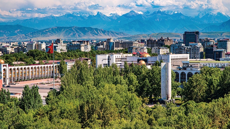
The population of Kazakhstan is around 16.000.000, the capital is Astana and the population is 1.200.000. 58.9% of the population is Kazakh, 25.9% is Russian, 5.8% is German, 2.94% is Ukrainian and 6.5% is of other nationalities. The main cities are Almaty, Shymkent, Atrau, Pavlodar, Karaganda and Aralsk.
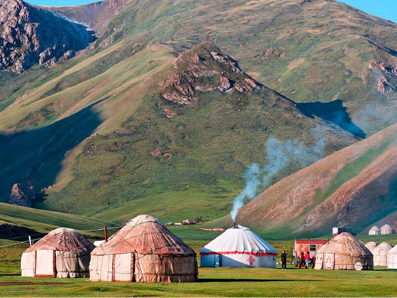
Kazakhstan still retains its old nomadic character except for the large settlements. Since most of the people make their living from animal husbandry, in summer they go to the highlands, which they call “chaylav”, and in winter they shelter in their winter quarters, which they call “kıştav”. Thus they continue their nomadic life.
Education Since most of the population lived a nomadic life before the communist revolution of 1917, educational activities in Kazakhs were not very developed. There were many madrasas in settlement centers. After the revolution, the Russian education system was introduced in the region. Although primary and secondary education was conducted in Kazakh, Russian education in kindergartens and higher schools forced Kazakh youth to learn Russian.
Education in Kazakhstan is compulsory and free of charge between the ages of 7-17. Russian and Kazakh are taught in schools. There are also schools teaching in minority languages. There are boarding schools for middle school children in areas with low population. The number of vocational schools is quite high. There are 8689 secondary schools and 243 technical high schools across the country.
The first university in Kazakhstan was established in Kirov in 1934. In 1948, the Kazakh Academy of Sciences was organized. There are more than 35 institutes affiliated to this academy. There are also around 40 higher schools.
Political Life
The Russian government made various efforts to make Kazakhs lose their national consciousness. During the Stalin period, Arabic and Persian words were removed from Kazakh and replaced with Russian words. Today, Russian words are used for some words in Kazakh. Thus, Kazakh was soon under the influence of Russian. The reason for this was that the Kazakh intellectuals, who did not learn their own language well, consciously or unconsciously used Russian in their writings. The degree of religiosity in Kazakhs, most of whom are Muslims, varies according to regions. In regions where Kazakhs are in the majority, religious belief is stronger, while in regions where Kazakhs are a minority, religious belief is weak. In Muslim-majority regions, Islamic and national customs and traditions are still alive. Before independence, anti-religious propaganda was very strong. Since 1948, nearly 150 anti-religious books in Kazakh have been published in Kazakh. Kazakhs are the third country among Muslim communities to have published anti-religious books in their language.
Economy
The country’s economy is based on agriculture, animal husbandry and mining. Since most of the land is covered with desert and mountains, there is little land suitable for agriculture. Most of this land is pasture. Agriculture in Kazakhstan can be considered in four regions: 1) Sedentary agricultural zone: Wheat, millet, sunflower and cattle are grown in the region. 2) Transition zone: In this area millet is grown and sheep are kept. 3) Animal feeding zone: Sheep are kept here. Horses and camels are also raised in Aktübe. 4) Artificially irrigated region: In this region, cotton, beet, tobacco, hemp, oilseeds and rice used in industry are grown.
Kazakhstan’s industry has developed depending on mining. Before leaving the Soviet Union, it met most of the raw material needs of this country. The main industrial enterprises are iron, steel, cement, fertilizer, sugar, flour, canned food, pharmaceuticals, synthetic yarn, X-ray equipment factories. Most of the industrial labor force works in coal mines and oil facilities.
Transportation
Transportation in Kazakhstan is provided by road, rail and air. The railway network is 21.400.000 km long and covers the country like a network. The length of highways is 189,000 km. Many cities have airports.
In raisin varieties, the drying stage of the grape also plays a big role in the value of the grape. On the one hand, grapes dried on specially built vines, on the other hand, grapes dried in the open air, in the shade, under the influence of the wind, and grapes dried in special warehouses made of adobe are offered to consumers. Visitors to the province, after visiting the cultural and historical heritage, relax with Uyghur culture, music, dances and hospitality in the Valley of Grapes covered with greenery between the Flame Mountain, called Hou Yan Shan by the Chinese. Guests are shown the vineyards where grape varieties and production methods are exhibited, given information and tasted.
In the grape valley, established on an area of 16 square kilometers at the foot of Flame Mountain, 10 thousand Uyghur families both produce and host guests from inside and outside the country.
 İyi İnsanlar Güzel Yarınlar İnşa Eder!